Bexar Street Master Plan
Dallas, Texas
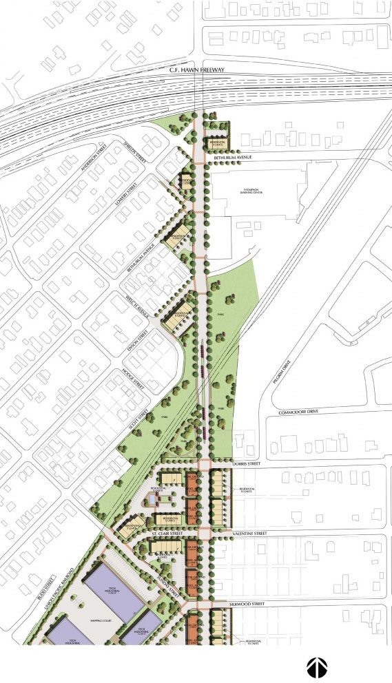
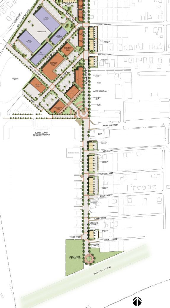
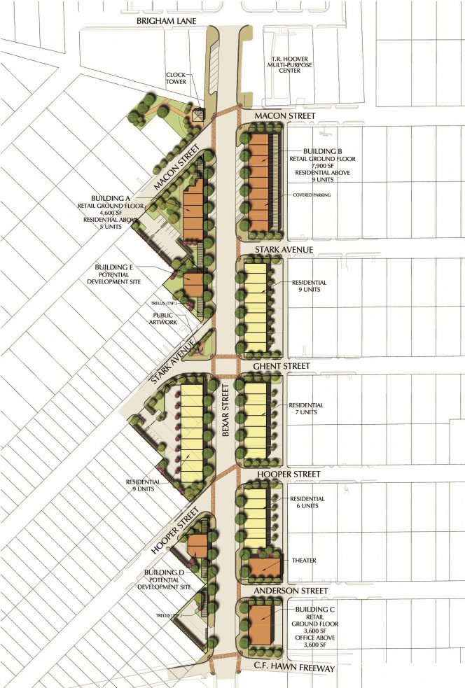
The Bexar Street corridor is a major north/south roadway in South Dallas that has the capacity to tie several small neighborhoods together and link to several strategic opportunity areas as recommended by the Trinity River’s Comprehensive Land Use Plan. The Dallas Housing Department’s goal to revitalize key neighborhoods using New Urbanist principles led to the assessment of the existing site conditions for the entire Bexar Street corridor in two phases, and prepare a land use plan for proposed infill commercial and residential development. From this plan a detailed streetscape site plan for the corridor was prepared that has served as a model street improvement for the City that promotes pedestrian friendly development. Townhome residential infill development has been constructed, with several city blocks of ground floor commercial with residential above along the corridor being in the development stages. Subsequent phases of the project have included the Department’s desire to branch out further into the adjacent neighborhoods while strategically using Bexar Street as the community’s heart of commercial activity.